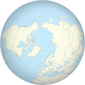
Skeda:Worldmap northern.svg

Size of this PNG preview of this SVG file: 553 × 553 pixel. Rezolucione të tjera: 240 × 240 pixel | 480 × 480 pixel | 768 × 768 pixel | 1.024 × 1.024 pixel | 2.048 × 2.048 pixel.
Dokument origjinal (skedë SVG, fillimisht 553 × 553 pixel, madhësia e skedës: 589 KB)
Historiku skedës
Shtypni mbi një datë/kohë për ta parë skedën siç ishte atëherë.
| Data/Koha | Miniaturë | Përmasat | Përdoruesi | Koment | |
|---|---|---|---|---|---|
| e tanishme | 1 maj 2013 13:34 |  | 553 × 553 (589 KB) | Gringer | updated script -- proper group ordering |
| 29 prill 2013 02:03 |  | 552 × 552 (465 KB) | Gringer | Updated perlshaper script | |
| 3 shtator 2010 11:31 |  | 550 × 550 (563 KB) | Gringer | Updated using [http://www.naturalearthdata.com Natural Earth Data]. | |
| 13 shkurt 2009 02:17 |  | 181 × 181 (308 KB) | Gringer | increase in ocean size to make border sit mostly outside land | |
| 13 shkurt 2009 02:10 |  | 180 × 180 (308 KB) | Gringer | {{Information |Description={{en|1=A polar projection of the northern hemisphere from Image:Worldmap_wdb_combined.svg. Created from [http://www.evl.uic.edu/pape/data/WDB/ CIA World Databank data] using an updated version of my [http://user.interface.o |
Lidhje skedash
S’ka faqe që përdorin këtë kartelë.
Përdorimi global i skedës
Kjo skedë përdoret nga Wiki të tjera në vijim:
- Përdorimi në en.wiki.x.io
- Përdorimi në pl.wiki.x.io
- Përdorimi në pl.wikinews.org
- Përdorimi në sl.wiki.x.io